
DIFFICULTY LEVEL: BEGINNER
Soledad Canyon Loop. This easy, four-mile loop northeast of Las Cruces offers a rich experience of the Chihuahuan Desert microclimates of the Organ Mountain–Desert Peaks National Monument. This popular trail leads you through a narrow canyon to a rare desert waterfall and pond teeming with bird life. Keep your eyes out for a small cistern and the ruins of an old cabin, both built by long-ago homesteaders. nmmag.us/soledad
DIFFICULTY LEVEL: INTERMEDIATE
Opportunity Loop Trail. This moderate, six-mile loop trail traces the forested rim of Lake Maloya, near the northeastern town of Ratón. While hikers, runners, and mountain bikers populate the route on weekends and holidays, it offers a nice opportunity for solitude during the week. The trail climbs a gentle 800 feet through springtime fields of wildflowers and deep green forests. The view of the lake is spectacular, but be sure to keep an eye out for all the wildlife. The area is great for birding. Deer, bear, and elk are common sights. Plus: Be sure to visit nearby Sugarite Canyon State Park for more fun outdoor activities. nmmag.us/opportunityloop
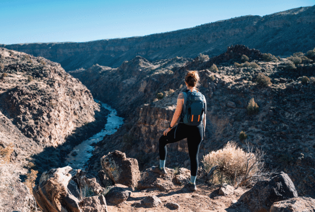
DIFFICULTY LEVEL: INTERMEDIATE/EXPERT
Gila Loop Trail. Located in the southwest corner of New Mexico, this 15- to 20-mile moderate to difficult trail departs from the Gila Cliff Dwellings National Monument and mounts one of the branches of the Gila River. A narrow, pine-filled canyon opens to a volcanic mesa blanketed in grasses and one of the best views in the state. You can do the loop in one very long day, but if you have the time, spend at least one night on the mesa. nmmag.us/gilaloop
DIFFICULTY LEVEL: INTERMEDIATE/EXPERT
Perk Ridge Trail. Near Ruidoso in the southeastern part of the state, the four-to five-mile trek is shaded, cool, and relatively easy while connecting with other trails, in case you want to keep going! Tracing a bubbling creak, the trail gains about 1,177 feet in elevation, but the view from the rock outcrop is well worth the effort. When the monsoon rains arrive, the area bursts with wildflowers and birdlife. nmmag.us/perkridge
DIFFICULTY LEVEL: EXPERT
Sierra Ladrones. Southwest of Albuquerque, the remote Thieves’ Mountains anchor a 45,000-acre Wilderness Study Area managed by the Bureau of Land Management. This difficult seven-mile hike is truly epic, so plan accordingly. There are no marked trails, very little water, and plenty of rattlesnakes, mountain lions, and occasional lightning. But don’t be scared off! Plan ahead, then hit the two toothy summits at 9,121 feet for an expansive view of central New Mexico. Bring food, water, maps, and perhaps camping equipment. Just in case. nmmag.us/sierraladrones