LESS THAN FIVE MILES into the nation’s first designated wilderness area, I scan the muddy banks of New Mexico’s last free-flowing river for animal tracks, wondering who else is here.
Low sunlight casts shadows into a deer’s heart-shaped hoofprint. Scat gives away the fox and coyote. I glimpse the orange underwing of a bird—maybe a northern flicker—floating down to its perch. Then, upstream, I see the surest sign of this valley’s residents: a beaver dam.
I have hiked to the Gila River’s Middle Fork by way of Little Bear Canyon with Luke Koenig, the Gila grassroots organizer of the New Mexico Wilderness Alliance, and Jay Hemphill, a photographer who spent last summer in the Gila Wilderness. We traversed a ridge, marveled at the snow-covered Mogollon Baldy, gazed through binoculars toward an Apache cave dwelling, dropped into a box canyon, wound through willow trees, and stopped at the ice-cold water, trickling as it does even without human witnesses.
Covering just these 10 miles in the 3.3-million-acre Gila National Forest leaves so many wonders unexplored. Even getting to know the 558,014-acre Gila Wilderness contained within the national forest would take a lifetime. But a sense of appreciation for its existence and wonder at nature’s perfect complexity can grow in a much shorter time.
Petrified ash columns formed roughly 40 million years ago in the Gila River valley.
It took conservationist Aldo Leopold only a few years in southern New Mexico to understand as much. As a U.S. Forest Service employee in the early 1900s, Leopold pushed the government to set aside large swaths of land for ecosystem function and recreation. “To those devoid of imagination, a blank place on the map is a useless waste,” he said, “to others, the most valuable part.”
Convinced of the region’s exceptionality, the Forest Service designated the Gila Wilderness on June 3, 1924, and over the next 40 years, shaped the Wilderness Act around Leopold’s ideals to protect our most pristine wildlands. Federal wilderness areas have no roads and prohibit mechanized transportation, so some of the national forest’s 528,000 annual visitors only ever view the pristine Gila Wilderness from a roadside vista. Others wander up to its edge and dive in. Anglers fish for Gila trout in the river’s waters. Geologists take interest in the landscape formed by super volcanoes. Birders flock to the transition zone, checking species like the Montezuma quail off their life lists. History buffs visit the birthplace of the legendary Apache leader Geronimo and see where the Mogollon Mimbres people created intricate black-on-white pottery. Horseback riders pack into the backcountry, while Continental Divide Trail through-hikers walk a route that crosses the Gila River 100 times when flow and weather permit.
“When we see land as a community to which we belong, we may begin to use it with love and respect,” Leopold wrote in the introduction to his A Sand County Almanac: And Sketches Here and There. Published posthumously, the book lays out his notion of land ethic—a relationship between people and nature. “Perhaps such a shift of values can be achieved by reappraising things unnatural, tame, and confined in terms of things natural, wild, and free.”
Although the boundaries and management tactics have changed over the past 100 years, Leopold’s vision is why the Gila Wilderness remains untrammeled and undeveloped. It’s also why we may finally be realizing that even as human knowledge evolves, it will never match the wisdom of nature.
The Gila Wilderness is one of the few places where fire is allowed to play its natural role.
BEFORE HEADING OUT THIS MORNING, we each hit “Start” on our GPS watches at the TJ Corral Trailhead near the end of NM 15. “It’s one of the wildernesses where you better know where you’re going,” says U.S. Forest Service ranger Henry Provencio. “That trail may not be there, and there may not be a sign.”
In the Gila Wilderness, visitors truly experience nature uninterrupted, says Provencio, pointing back to the mid-1800s, when Apache leaders Geronimo and Victorio defended this area. “This place looks largely like it did when those folks were here,” he says.
This region has remained unspoiled over the past century partly thanks to low visitor numbers but also due to careful management of its interconnected systems. Native species like elk, Mexican gray wolf, and the endemic Gila trout can be spotted today because biologists have worked to undo the effects of previous practices—including the introduction of nonnative trout for sport fishing and the eradication of wolves by ranchers and the federal government. Over time, it has become clear that the best management tactic is to leave a wild place alone.
At first, we climbed a mellow hill through a grassy ridge dotted with juniper, some apparently charred. None of us could remember exactly when this area last saw fire. Without human intervention, floods or fires that some might label natural disasters simply get characterized as normal—events expected to occur in a Southwest landscape. “These systems are functioning as intended, without interruption from man,” Provencio says. “Today, we’re in the largest landscape where fire is playing its natural role.”
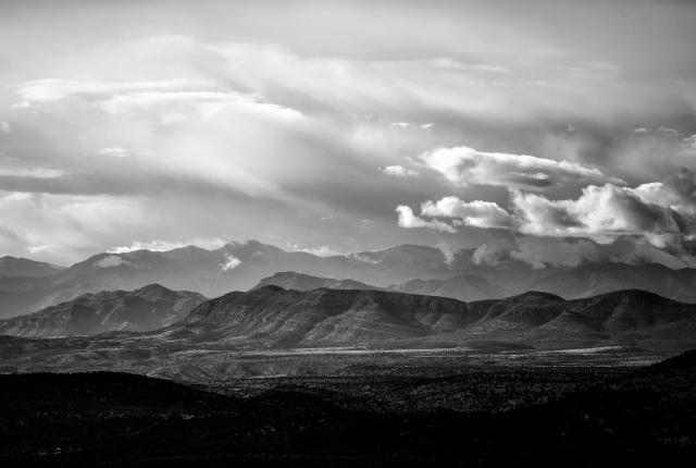
A majestic view of clouds, peaks, and valleys unfolds at Hillsboro Peak lookout, in the Gila National Forest.
As the cliffs of Little Bear Canyon closed in around us, my gaze narrowed, too. I noticed a large chunk of quartz nestled in the sand. Watercress sprouted a vibrant green in the trickle below. A bed of oak leaves flowed into the curve of our path, then a tree trunk with obvious signs of past strangulation: indented rings around its circumference. I stepped off the trail. Lower down and partially hidden behind the branches of a smaller shrub was a rusty twist of wire cut three inches from the trunk.
“This must date back to before the wilderness designation,” I guessed.
Koenig shook his head. “Not necessarily.”
Hemphill recalled that fences sometimes get installed in box canyons to keep out cattle.
At first, ranching was considered compatible with wilderness preservation. But as Leopold’s view developed, he spoke of humans’ continual battle against nature’s forces, identifying Southwest creeks and rivers that had been affected by erosion and flooding after the onset of agriculture and the timber industry.
Three manmade lakes in Gila National Forest are all stocked with rainbow trout the in fall, winter, and spring.
In May 1924, Leopold’s “Pioneers and Gullies” was published in Sunset Magazine. The first step in watershed conservation, he wrote then, is to maintain grass cover on the range. The next, reduce the grazing out of willows. “In the Southwest, there has been a striking coincidence between the inception of erosion and the eating out of the native willows by stock,” he argued. “Therefore, many bottoms will have to be fenced and merely lightly grazed as reserve pastures, and the willows artificially restored. Riprapping with woven wire fencing strung parallel with the bank on green spring-set cottonwood posts, which grow and form trees, is a cheap and good method.”
With no way of confirming whether this tree was involved in the exclusion of cows or replacement of native willows—or neither—I shrugged and continued toward the Middle Fork.
Little Bear Canyon unloads into the river’s high-walled valley. Again, my perception changed with the landscape. Rising hundreds of feet are at least two dozen textured rock columns, evidence of the super volcanoes that formed the Gila region 40 million years ago. Ponderosa pine and Douglas fir trees compete in the reach for the sky, while oak and box elder fill in the understory.
I last backpacked before my daughter was born five years ago, so being here today is like returning to a memory from a previous lifetime. But Koenig trekked to the Middle Fork less than two months ago, and Hemphill passed through six months back. The beaver dam we immediately noticed just upstream had been absent during their recent trips. While Leopold didn’t mention beavers in “Pioneers and Gullies,” the semiaquatic rodents occupy a central place in the ecosystem—and in our consciousness. Steering us through the front country of the Pinos Altos Range earlier in the morning, Hemphill noted he’d seen more beaver in the Gila lately. Koenig, without revealing his favorite fishing holes, hinted, “There’s something that’s difficult to put into words about fly-fishing in a beaver pond miles into the wilderness.”
One of the most enjoyable ways to spend time in the Gila National Forest is by exploring its vastness on horseback.
A study by the National Park Service demonstrated “that beavers and their associated dams play an important role in the formation, function, and persistence of riparian wetlands.” By creating more complex river flows, beavers produce healthier wetlands, which absorb carbon dioxide from the atmosphere, increase biodiversity, and raise the water table, stabilizing threatened ecosystems.
For a closer look at the fresh dam, I walk up the bank between cliff and river. From this higher perspective, I see it is twice as long as it appeared. At least two or three feet deep, the pond above it reflects the cliff and surrounds a stand of white alder—some trunks soaring tall and giving way to still leafless branches, others gnawed off just above the water level.
Above beaver dams, water gets filtered of contaminants and excess nutrients like nitrogen before reentering the main channel downstream. According to new research by Stanford University scientists, “when it comes to water quality in mountain watersheds, beaver dams can have a far greater influence than climate-driven, seasonal extremes in precipitation.” Fortuitously, the study says, beaver populations have increased at the same time the Southwest grows hotter and drier.
Get a glimpse into the homes and lives of the Mogollon people at the Gila Cliff Dwellings National Monument.
As Leopold’s view of things natural, wild, and free evolved, he began to understand that the most rewarding connection someone can make with the land is by really looking at it—seeing it fully and recognizing their role in it, passing a deep wonder and sense of community down, like genes, to the next generation.
Before leaving, Hemphill leads us downstream and points to an isolated face in the cliff. Red stains form intentional triangles, lines, and half circles. My eye is drawn to a diamond shape that, when faced head on, appears topped with a small head. Tiny appendages sprout from the midpoint of the two top sides. I can only faintly make out a shape—an adjoining triangle—hanging from the lower apex, almost like a wide tail. I know I’m wrong, but I could swear I’m looking at a drawing of a beaver.
Read more: A grassroots organizer, Luke Koenig builds community around protecting our wild places.