
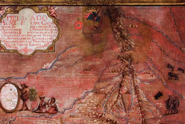
Above: Miera y Pacheco's map. Photograph courtesy of the New Mexico History Museum.
Don Bernardo de Miera y Pacheco won 18th-century renown as a soldier, explorer, cartographer, and remarkable painter and sculptor. The oil-on-canvas map above is one of several crafted by him or others using drawings he made for the Spanish government around 1758. One of the earliest known maps of the region’s landscape and residents, it was revelatory for its depiction of rivers, mountains, abandoned towns, various pueblos, nomadic tribes, mission churches, and a group of frolicsome buffalo.
This version is in the collections vault at the New Mexico History Museum. Its Telling New Mexico: Stories from Then and Now exhibit bears a print of another one painted in easier-to-read pastel blues, the original of which belongs to the Museo Nacional del Virreinato, in Tepotzotlán, Mexico. For Alicia Romero, a curator at the history museum, the map represents one culture’s political power to apply new names to places and people—a phenomenon that recurred when New Mexico became a U.S. territory and has evolved yet again as Native peoples reassert their indigenous names.

The New Mexico History Museum is at 113 Lincoln Avenue in Santa Fe. Call 505-476-5200 or visit their website.