WITH A 7,300-FOOT ELEVATION, abundant sunshine, and crowd-free trails, Los Alamos calls out to mountain bikers, hikers, and everyone else who revels in the great outdoors—including Olympic athletes who train here for the low-key atmosphere and high-elevation benefits. Once the home of Ancestral Pueblo people and now a gateway to three national parks and a center for innovative science, this friendly mountain town invites extraordinary adventures. “If you love nature,” says Los Alamos County spokesperson Cory Styron, “this is the place to be.”
Hiker’s heaven. You’ll find adventure outside every door thanks to the 150-mile Los Alamos Trails Network that winds through town and connects to Pajarito Mountain Ski Area, Bandelier National Monument, Valles Caldera National Preserve, and the Manhattan Project National Historical Park. Operated by the Pajarito Environmental Education Center, the Los Alamos Nature Center gives you a lay of the land with a large-scale topographical map, demonstration gardens, live animals, planetarium shows, interactive exhibits, and docent-led programs.
Catch a view on two wheels from Los Alamos’s Pajarito Mountain. Photograph courtesy of Visit Los Alamos.
Bikers’ bliss. Mountain bikers are on top of the world here, with high-altitude trails for every skill level. Pajarito Mountain offers lift-served mountain biking, technical trails, and a bike park with 30 freeride, downhill, and cross-country trails when ski season ends. In town, trails dial up phenomenal views in every direction. Each summer, the annual Pajarito Punishment mountain bike race (June) and Los Alamos Triathlon (July) test the mettle of the competitive set.
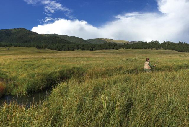
Fantastic fly-fishing. Formed 1.25 million years ago by a colossal volcanic eruption, the nearly 89,000-acre Valles Caldera National Preserve cradles sparkling waters filled with trout. At the confluence of the Jemez River East Fork and Jaramillo Creek, narrow grassy banks provide an ideal feeding area for trout. As the East Fork continues, it widens, deepens, and slows, creating an excellent habitat for large browns and rainbows. San Antonio Creek’s open northern stretch requires a stealthy approach from anglers, while the lower end’s long, gravel-bed shallows make pinpoint casts vital to hooking the luggers.
Three Hikes to Try
Here are trails that locals love.
Los Alamos Canyon Rim Trail. Accessible from downtown, this easy, two-mile paved pathway provides 360-degree views of the canyon and Los Alamos National Laboratory campus.
Cañada Bonita Trail. Near the Pajarito Mountain Ski Area, the moderate five-mile trek through a lush meadow showcases mariposa lilies and other wildflowers that bloom from spring through summer.
White Rock Canyon. Choose your level of difficulty with the easy 3.6-mile Rim Trail or the difficult 7.8-mile Blue Dot/Red Dot Loop Trail, which descends 900 feet to the Río Grande.