HEADING EAST ON I-40, ROLLING HILLS covered in piñon-juniper scrub give way to the grasslands of the southern Great Plains. Other than the big blue sky and an occasional dramatic thunderstorm, the sameness of the landscape numbs me into a driving stupor.
Then, about three miles before Santa Rosa, the landscape does something interesting: The bottom drops out. The town sits in a six-mile-wide sink, where soluble layers of limestone and gypsum have collapsed. Within the sink, a series of nine sinkhole lakes (or cenotes), multiple springs, and ciénegas (arid-land wetlands) line the Pecos River corridor, harboring life found nowhere else on earth. This is where Santa Rosa gets its moniker, City of Natural Lakes. It is also just one of the many features that give southeastern New Mexico something to brag about. There are hidden treasures in karst country.
“Karst, much like mountains and beaches, is a landscape,” says George Veni, executive director of the National Cave and Karst Research Institute, based in Carlsbad. It is formed over time when water dissolves certain types of bedrock to create sinkholes, springs, and caves. Karst landscapes look different all around the globe. “The karst in New Mexico is subdued, topographically,” says Veni. “You don’t notice the landscape has been dissolved away unless you go underground.”
Mescalero Sands welcomes OHVers.
“Karst covers 25 percent of the country,” he continues. “About 700 million people worldwide depend on karst groundwater as their water supply, but most people have never heard of it.” That’s a bit of a problem, Veni says. While the world’s largest springs and aquifers come from karst, this water supply is also incredibly vulnerable to contamination. “Protecting the source area is critical.”
First, we need to know it is there. I’ve been hearing about karst for several years, so I’m dedicating a few days to explore New Mexico’s best examples. On a late-summer day, I aim my car toward a landscape that I usually just drive past, this time hoping to discover the natural wonders of southeastern New Mexico.
Read more: Three accessible, delightful hikes for even the most casual outdoorsperson.
The karst spring that produces the main natural attraction in Santa Rosa, the 30-foot-wide and 80-foot-deep cenote known as the Blue Hole, releases water at an impressive 3,000 gallons per minute. Its crystal-clear water attracts scuba divers from around the world. But Blue Hole is only one of the many karst formations in the Santa Rosa Basin.
Cenotes, springs, and ciénegas dot city and private land here, and few of them are open to public access. Larry Stevens, a biologist who studies spring ecosystems in the Southwest, contends that the region could be a national monument. The alkaline water of the formations attracts migrating birds, breeds unique microbacterial life and rare flora, and harbors aquatic invertebrates and fish species. “It’s a place like none other on earth,” says Stevens.
BLUE HOLE IS USUALLY AS FULL OF PEOPLE as a spring puddle is with tadpoles. The kids are back in school, however, so the lake is relatively quiet. I walk down a set of steps into the cool, 61-degree water. It feels silky on my skin and tastes slightly salty from the gypsum layers it has flowed through on its long underground journey. It’s amazing to think that rain or snow untouched by human industry fell on the Sacramento Mountains as long as 10,000 years ago and is now emerging into daylight through the gushing spring beneath me. I wonder at the stories this water holds.
Bubbles break the surface to my left. A Russian scuba diver comes up for air, pulls off his hood, and rests against the wall. A second guy swims up near him. An overheated Texan from Amarillo, he and his family made the two-and-a-half-hour drive to take a cool dip. They are unaware that they have immersed themselves in ancient history.
Blue Hole empties into a spring run, flows through the parking lot, and crosses the road, where it forms a ciénega that is now a 116-acre nature preserve. Families play in the spring run alongside rare, endemic roundnose minnows. The preserve blooms with the rare Pecos sunflower, Wright’s marsh thistle, and an occasional ladies’ tresses orchid, all celebrated annually at the Pecos Sunflower Festival, held the second week in September, with music, arts, markets, classic car shows, and conservation activities.
Cenotes at Bottomless Lakes State Park.
After cooling off in the water, I head south from Santa Rosa on US 84, following the Pecos River toward Roswell. Huge wind turbines dot escarpments in the distance while old livestock windmills spin and spin, striving to draw water. Long trains parallel the highway, inviting a race. The big, puffy white clouds of late summer create shadows on land, disrupted only by long stretches of sagging fences.
Read more: Route 66 still draws cruisers to Santa Rosa. Hop off the main drag, where nostalgia and adventure await. (Bring a swimsuit!)
As I drop into the Roswell Artesian Basin, karst reveals itself again. An escarpment of impenetrable rock on the eastern side of the Pecos River Valley forces water from the underlying San Andres aquifer to the surface. Traces of sulfur and salt linger in the air from the gypsum-laced water. The area has been designated a Ramsar Wetland of International Importance for the rare species it holds and the thousands of migratory birds that depend on it. The Ramsar site includes Bottomless Lakes State Park, to the south of US 380, and Bitter Lake National Wildlife Refuge, to the north.
A drive into Bottomless Lakes State Park reveals nine cenotes, deep lakes that fill from the bottom up by springs. Two-inch-long desert fish, barking frogs, tiny snails, and shrimp-like creatures call these waters home. At the park’s only developed lake, Lea Lake, a grandmother tries to command the six kids in her charge as they dig in the sand and splash around in the water. A trio of young friends kayak on the calm water. Its dark depths have inspired myths of strange creatures guarding an endless bottom. A spring that fills Lea Lake flows out into a ciénega, much like at Blue Hole, in Santa Rosa.
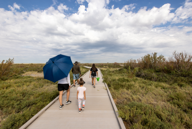
I cross the wetlands on a boardwalk that leads to three bird-blinds overlooking ponds lined with cattails. A family sits peering over the edge of the boardwalk, looking for the Pecos pupfish and other desert fishes.
from left
A birder at Bitter Lake National Wildlife Refuge; A greater yellowlegs at Bottomless Lakes State Park.
Later, I arrive at Bitter Lake National Wildlife Refuge’s modern visitors’ center. “Summer is the best time to see the dragonflies,” says Merideth Hildreth, president of the Friends of Bitter Lake. “That’s what inspired me to become involved in the refuge.” Over 90 species of dragonflies and damselflies have been identified here—the richest diversity of these fancy fliers in the country.
In August, not only dragonflies buzz the water-filled flats. A least tern, a seabird recently removed from the Endangered Species List, has been nesting, along with snowy plovers that feed in the mudflats in a remote sector of the refuge. Each October, thousands of sandhill cranes and snow geese also arrive at the refuge, lured by the open water to make a refueling stop on their migratory journey to winter grounds farther south.
After a turn around the six-mile wildlife-watching loop, I head south, following the path of the Pecos River again to New Mexico’s showiest karst area: Carlsbad Caverns. Its subterranean depths and eroded marvels have earned it national park status, but Veni gives me a tip on where to find the entrance to the second-largest gypsum cave in New Mexico, so I skip the park and the crowds and head to the lesser-known karstic wonder.
Read more: The weather may be cooling down, but birds are just taking flight for their fall migration. If bird-watching is the name of your game, swoop down to these New Mexico destinations.
In an empty dispersed camping area, I stand before three of the 18 cave entrances in the Chosa Draw area. One is flooded. A rattlesnake guards the second. I choose door number three. The cave is tall enough for me to stand up in most places, and not much wider than my outstretched arms. White gypsum powder dusts the floors and piles up in nooks in the walls. Underneath the dust, marble-like white gypsum sparkles in my headlamp’s beam.
I walk some distance into the dark, guano-scented cave. A bat flies from its perch above, an albino cricket crawls on the walls. I’m the only other being I can detect in the cave. These caves go on for more than four miles underground, with stretches that require crawling, swimming, and squeezing. As a novice caver, alone and mindful of the warning signs at the entrance about potential flash flooding, I don’t venture too far. I peer into the darkness, past where my light reaches, and decide to return another day, with company.
A hiker emerges from a wild cave in the Chosa Draw area, near Carlsbad Caverns National Park.
FOR MY FINAL STOP, SITTING BULL FALLS, about 20 miles West of Carlsbad, I drive through a wide canyon covered in soaptree yuccas, mesquite trees, prickly pear cacti, and ocotillos flush with green leaves after August rains. I arrive at a developed picnic area with several rock shelters, built by the Civilian Conservation Corps in 1940. A paved path leads to the falls, tucked into the canyon.
As I round a corner, a waterfall comes into full view. It is more beautiful than I imagined. Water from a karst spring cascades over the edge of a cliff covered in water-loving ferns and wildflowers. Pools at the foot of the waterfall are large enough for people to swim alongside aquatic beetles and dragonfly nymphs.
For a while, I have the place to myself, until I hear a voice calling from above. Five cavers pop out from an entrance I hadn’t seen, behind a second, smaller waterfall. They tell me they’ve spent the morning exploring a wild cave, thanks to a permit from Carlsbad Caverns National Park. A few more groups start walking in from the parking lot, taking pictures of the falls; some brave the cool pools for a swim.
On my way home, heading north, I pass the National Cave and Karst Research Institute’s building in Carlsbad. Veni tells me they are celebrating the International Year of Caves and Karst with workshops and events around the world. The ground floor of their building will soon be a science museum with a Cave Discovery Zone, where people can test their cave-rappelling skills.
In four days of exploring, I’ve barely made a dent in all that southeastern New Mexico has to offer. But my eyes have been opened to the wonders and magic of karst. “Pretty much everyone around the world is touched by or benefited by karst in some ways,” says Veni. “They just don't know it.” Yet.
Read more: New laser technology reveals tantalizing secrets about everyone’s favorite cave.
Play Time
Southeastern New Mexico tends to stay warmer than the rest of the state in the winter months, making it a great place to recreate.
Stay. Sumner Lake, Brantley Lake, and Santa Rosa Lake state parks offer opportunities for birding and water sports along the Pecos River and camping on the edge of reservoirs. Bottomless Lakes State Park has two campgrounds, at Lea Lake and Lower Lakes, near the visitors’ center. At Fiddler’s Inn Bed and Breakfast, near downtown Carlsbad, each room has a playful theme and cozy accommodations. Homemade cookies and a complimentary breakfast at Blue House Bakery & Café are included.
Eat and drink. Beat the lull of the drive with specialty coffee drinks and pastries throughout your trip. In Santa Rosa, Mr. Bee’s Coffee and Teas lets you order ahead online, so your mocha latte is hot and ready when you’re in a hurry to see the birds. At Roswell’s Stellar Coffee Co., don’t miss the house-made ice cream sandwiches. Blue House Bakery & Café, in Carlsbad, specializes in full breakfasts served alfresco. Upscale meets homemade at Carlsbad’s YellowBrix Restaurant, in a renovated historic building with a large patio and friendly ambience. Open for lunch and dinner every day, plus brunch on weekends, it serves soups, wraps, prime rib, and margarita chicken, plus an impressive selection of wine, beer, and coffee drinks.
Explore more. The Bureau of Land Management oversees the Mescalero Sands North Dune Off-Highway Vehicle Area, near Roswell. Besides OHVs, you’ll encounter the tiny sand dunes lizard, thousand-year-old dwarf oak trees, white-tailed deer, Ord’s kangaroo rat, small beetles, roadrunners, and lesser prairie chickens. It’s open year-round, with dispersed camping and pit toilets. The state-owned Melrose Migrant Bird Trap, a stand of cottonwoods, is the tallest feature between Fort Sumner and Clovis. Look for yellow warblers, vireos, northern flickers, flycatchers, owls, and other woods warblers. Forty-five warbler species have been identified in this bite-size habitat—more than at any other location in the country.